Detour #02: The World's Most Dangerous Road, Bolivia

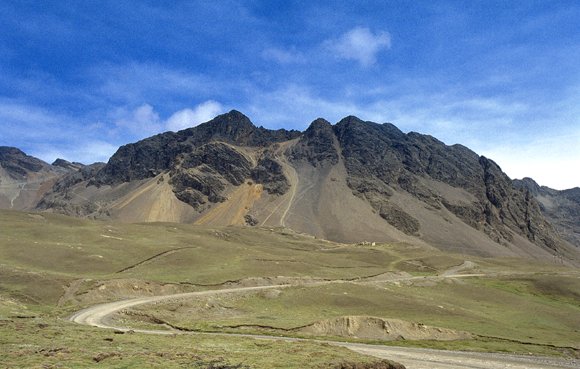
El Camino del Muerte, Bolivia’s Death Road drops 3000 metres in less than 70 kilometres (43 miles), winding its way down the mountain from La Paz, through waterfalls, around landslides, past thick rainforest and down to the coca plantations that surround Coroico.
It's the only road in South America where you drive on the left. Vehicles climbing up from Coroico hug the mountain and have right of way, while those coming down from La Paz get to see the murderous drops at close hand. In many places the gravel track is only one car wide and the vertigo-inducing drops spell the end for anyone unfortunate enough to get it wrong.
I drove this road in 2005 in the relative safety of a Range Rover and it was still terrifying. The armed cocaleros didn’t help either.
Captain Henard Romero of Police Rescue gave me some sobering statistics. “In eight years I have attended maybe 30 accidents involving about 250 people,” he said. “Of those we have rescued around 100. The reason that the death toll is so high, is that the trucks and buses that travel the road are overloaded with people. In 2002 we had four buses that went over the edge.”
Henard was quite detached talking about his work. Bespectacled and in his mid-thirties, he had the look of a doctor, not a seasoned policeman. Despite describing scenes of complete horror, of open torsos and screaming victims scattered throughout disaster scenes, he spoke without emotion. Except when I called the road the Death Road.
“I do not like that term. It is just a road,” he said firmly.
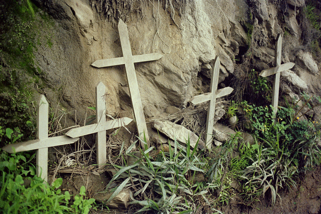
Nonetheless, there are more than a dozen memorials to those who have perished along this route. Dramatically changing weather, visibility and the sheer altitude combine to make this road a daily heart-stopping challenge for locals and adventurers alike. I find a plaque in Hebrew to commemorate the life of a 23-year-old Israeli tourist who lost control of her mountain bike and plummeted over the edge. Despite this mountain biking is a huge business with more than 250 bikers heading downhill from La Paz everyday in the peak season.
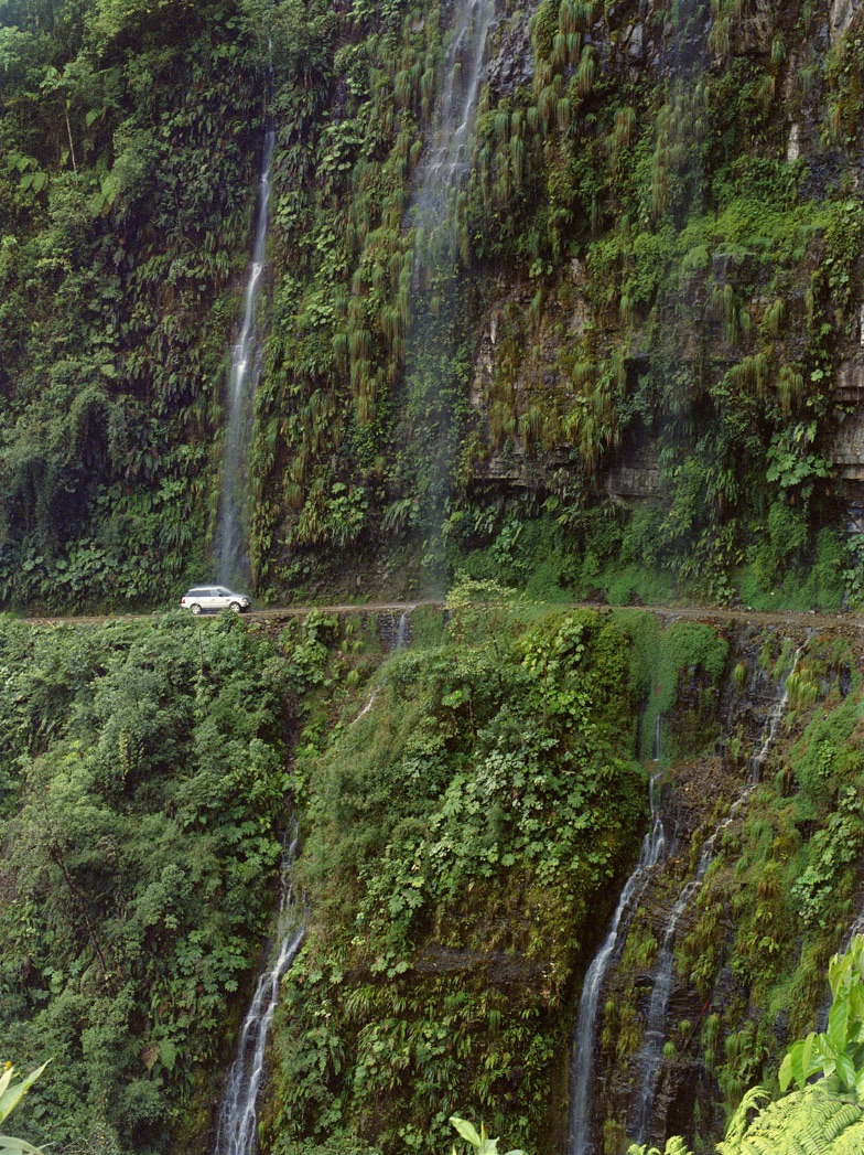
Around the corner a waterfall thundered down on the road. In a Range Rover, with the wipers on, it was frightening enough as the force of water dropping from 100m above hits the car. On a mountain bike it must be miserable.
As the ascent continued great banks of cloud filled the valley. This is a view you’d normally only get from an aeroplane. And when that cloud swept in across the road I’d certainly have been happier if there was a parachute under my seat.
The next section was the most dangerous of all. The road was rutted, narrow and twistier than ever. Prodigious use of the horn was required to let on-coming traffic know I was coming. I kept the car as tight into side of the mountainside as possible. Even so, there were plenty of times when I had to brake to standstill or even reverse to let other vehicles past.
At six key danger spots some help is at hand. Volunteers act as human traffic lights holding red or green signs up to shepherd the traffic. 52-year-old Timoteo had been flagging traffic everyday on Death Road for the previous 12 years, with just a small timber and tarpaulin shelter to protect him from the elements and surviving on handouts from grateful drivers. Why did he do this? Because in 1978 he lost his family over the edge and he wanted to prevent it happening to someone else.
It’s at these points that the road really lives up to its reputation. The chances of surviving an accident, let alone being rescued are very very slim. As a young medical student our guide Hugo had been driving along the road with his father in law. A few hours earlier a truck had gone over the side.
“We could still hear the screams,” says Hugo. “I wanted to try to help, but my father-in-law drove on. ‘What would you do?’ he asked me. ‘You’d just kill yourself.’ He was right, but I will never forget that.”
Neither will I.
Roadbook
Class: Mountain pass, jungle
Name: North Yungas Road, Route 3
Route: La Paz to Coroico
Country: Bolivia
Distance: 47 miles