
Detour #43: Swakopmund to Windhoek, Namibia

200 miles of parched desertscape separate swakopmund on namibia’s atlantic coast from its capital windhoek.
The quickest route is to take the paved B2, but the more adventurous option is to tackle the undulating gravel of the C28. Either way Swakopmund makes for a fascinating start to a desert drive.
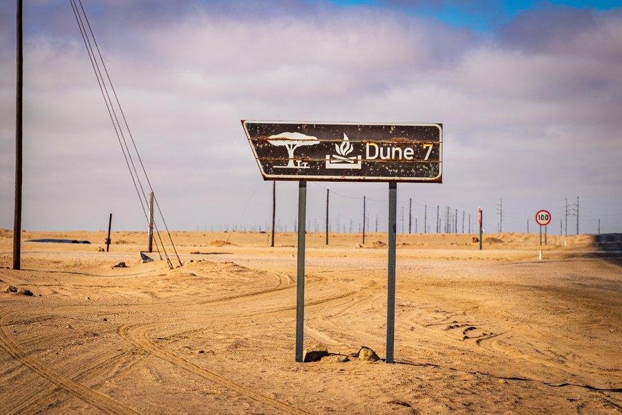
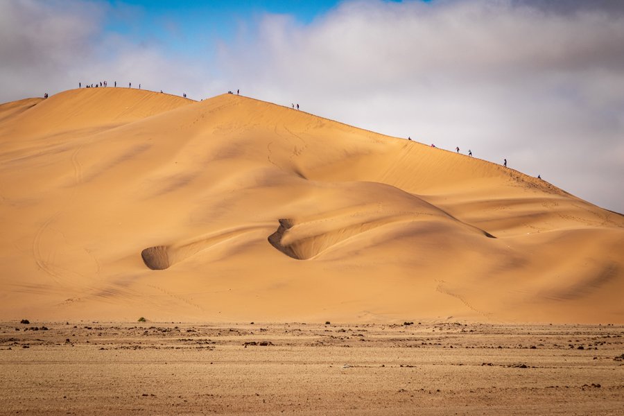
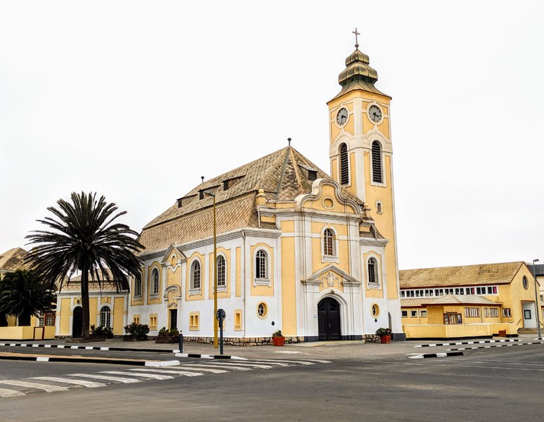
This former German colonial outpost looks like it could have been lifted from Bavaria, complete with picturebook architecture, a brauhaus and plenty of cafes serving apple strudel. Many travellers will head north to explore the Skeleton Coast, others will detour south to Walvis Bay for whale watching or quad-biking and sand surfing on the massive Dune Seven (you will get sand in every body crease and crevice, but it’s huge fun).
But if you want to experience the emptiness of the Namib desert and a drive that’s pretty much a 200-mile special stage, with the chance to recover in big city comfort at the end, then take the C28 eastwards.
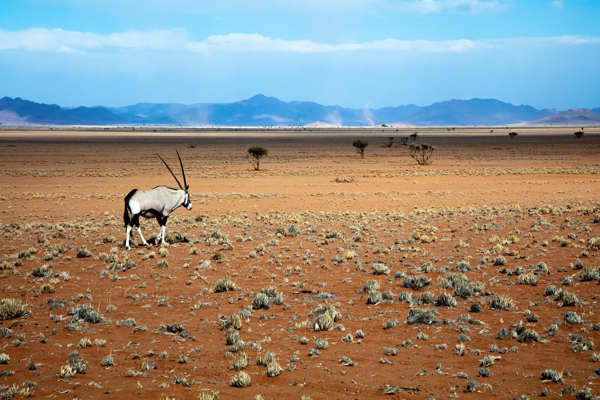
Departing Swakopmund it’s a matter of minutes before you’re into the desert on an almost-arrow-straight section of asphalt, the sand spilling over, washing across the smooth surface. The only company for miles is a water pipeline that runs parallel to the road and serves the region’s uranium mines, which also happen to be the only signs of life for many, many miles.
You soon enter the Namib-Naukluft national park where, permits permitting, you can detour to view the spectacular Moon Landscape, where the desert adopts an incredible extra-terrestrial appearance. By now the paved road will be a distant memory, the wide swathe of gravel cutting through to the horizon soon becomes familiar. The road rises almost unnoticeably as you progress through the national park. By the time you start to spot a few farms you’ll be at over 1100m of altitude. And you will keep climbing over the Great Escarpment on the Bosua Pass. The twists and turns are welcome after so many miles of driving in a straight line. But it’s no African Stelvio Pass so you’ll need to take it steady. The good news is that trucks, trailers and caravans are banned so traffic is light. The bad news is that it is seriously steep - up to 20 per cent gradient in parts. The views from the top are just breathtaking.
The descent is more gradual, and more straight but don’t take it for granted. There are are dips and troughs to catch you unawares. I have a vivid memory of photographer Philip Lee Harvey getting his Toyota Corolla rental car fully airborne as I followed in a Mazda CX-7. Only a sharp stab of the brakes prevented me from doing the same thing.
As you approach Windhoek you may see kudu and springboks, where previously your only company would likely be hyenas. You’ll also find the von Francois fort, built from stones by a Major Curt von Francois in 1890 and as you edge closer to the capital you’ll come across the Liebig House sitting alone on a hillside, long-abandoned by the Liebig’s Extract of Meat Company that built it in 1911.
Around 20 miles before Windhoek you’ll be back on asphalt, smoothly sailing in to this modern city, with its high-rises, clean streets and the end of this awesome African drive.
Words Nik Berg Twitter | Instagram
Photography Richard Van Wingaarde / Grant Durr / Alan J. Hendry / Unsplash
ROADBOOK
Class: Desert storm
Name: Coast to capital
Route: C28 Swakopmund to Windhoek
Country: Namibia
Distance: 207 miles