
Detour #151: Island hopping in the Outer Hebrides, Scotland
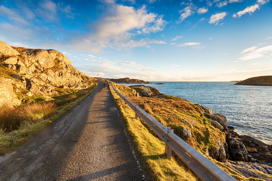
The aptly-named Golden Road on Harris Photo Shutterstock
You might spend almost as much time on ferries as driving but a road trip to the 15 islands in the Outer Hebrides is like nowhere else in the United Kingdom. Simon Heptinstall loved it so much he even got hitched.
Clutching the deckrail of the car ferry, setting off from Oban into some of Britain’s choppiest waters, I was wondering what I’d let myself in for this time. I was spending five hours crossing the Hebridean Sea, or as locals call it ‘The Minch’, in order to drive onto a tiny treeless island that’s just four miles wide.
It started as an armchair fantasy roadtrip. You know, staring at the map, then one thing leads to another… and suddenly I find myself embarking on a 174-mile detour along the entire chain of Scotland’s Western Isles, from Vatersay to the Butt of Lewis.
After landing on the southern island of Barra, I soon discovered that once you’re here, one thing leads to another here too. In fact, one of the great charms of this drive is these 15 inhabited islands are linked by a series of causeways, bridges and ferries, like a string of pearls.
In some ways I was discovering Britain’s daftest drive. The ferry costs more than a cross-channel trip. Because of their awkward timetable it took me three days to reach the Hebrides from southern England. I could have driven to the sunny Mediterranean much more quickly and cheaply.
The reward for the Hebridean hassle, however, is driving through a unique wild, windy landscape between vast lochs and deserted sandy beaches. These islands are untamed, rarely pretty, but often inspiring.
The Mediterranean might offer better wine, swimming pools and superyachts – but you won’t see so many otters, seals, standing stones, thatched blackhouses and bagpipe players.
By the time I drove off the ferry at Castlebay in Barra, I’d seen a hint of the sort of thing that makes this road trip so special. Standing in the sea offshore is the medieval Kisimul Castle, an impregnable MacNeill clan fortress (although recently leased by them to Historic Scotland for a nominal fee of a bottle of whisky a year).
I did a short loop to see the most southerly inhabited Hebridean island, Vatersay, via its new causeway. This was so welcomed by isolated islanders they started driving precariously across the rough rock foundations before tarmac was even laid on top.
Normally though, there’s nothing hard about driving in Scotland’s far western fringe. Roads are quiet, smooth and well signed. Most are single lanes with passing places. And settlements that look promising on the map usually turn out to be a few scattered bungalows. I found the ferry ‘terminal’ at Aird Mhor is just an unattended slipway. The road simply plunges into the sea.
After a 40-minute crossing I drove onto little Eriskay, where the Politician Bar still has a few of the 40,000 cases of whisky scattered when the SS Politician ran aground here in 1941, inspiring the 1949 Ealing comedy Whisky Galore.
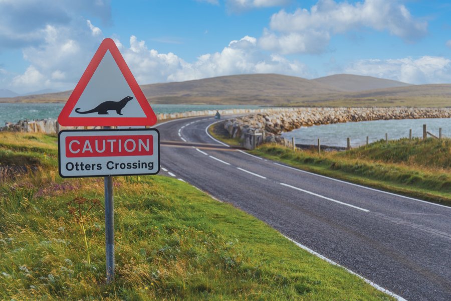
Watch out for otters on Uist! Photo Shutterstock
After what must be the world’s only road sign warning of ‘otters crossing’ another causeway leads to South Uist. The two-mile strip cost £9.5 million but when Prince Edward tried to open it the weather was so fierce the ribbon palava was hurredly abandoned. A makeshift ceremony was held in the nearby community hall.
An inconvenient shower on the mainland can become a serious hurricane out here. Locals warn of 100mph-plus cross winds and waves surging over causeways. On a sunny day however, there are few better driving roads. Finding your way is easy: keep driving north.

Rush hour on South Uist Photo Gordon Williams / Unsplash
On the island of South Uist I spotted roadside shrines to the Virgin Mary, demonstrating a proud Catholic tradition. A few causeways to the north, North Uist is contrastingly staunchly Presbyterian. Many locals strictly observe the Sabbath and glare grumpily from under Victorian bonnets as I drive merrily by on The Lord’s Day.
The Isle of Benbecula, which separates the Uists, is known locally as ‘the dark island’. Its hills, lochs and mountains are virtually uninhabited. On a clear day you can see the World Heritage Site of St Kilda 40 miles west.
Another short ferry took me to the Isle of Harris, once voted ‘Europe’s best island’ by TripAdvisor users. I drove past empty white sand beaches to reach a dramatic mountain pass through the ridge of Clisham, the highest Hebridean mountain at 2,621ft.

Scotland’s Stonehenge, the Callanish Stones Photo Gordon Williams / Unsplash
Harris and Lewis are joined, so I followed the road twisting down into the flat, rather-alien Lewis landscape of tiny lochs and lakes. I stopped for the must-see sight: the atmospheric Callanish Stones, Scotland’s answer to Stonehenge. These mysterious grey pillars are up to 16ft high in a cross pattern with a circle at the centre, around a chambered tomb. Unlike Stonehenge, you can park alongside and walk freely among the stones.
Eventually I reached a less mysterious structure, the sturdy Victorian lighthouse at the Butt of Lewis, which oversees huge seas crashing against the UK’s most northwestern point. It was originally powered by local fish oil, now its powerful electric light flashes ominously across the vast northern Lewis peat bogs at night.
The Guinness Book of Records gives this headland the accolade of the UK’s windiest spot. Bizarrely, and it’s another story for a different day, it’s where I got married. I’ll just say it was very cold and windy posing for the photos here.
Finally I turned south to the only town in the Outer Hebrides. Stornoway is hardly Los Angeles, but there are some pebble-dashed shops, take-aways… and, of course, the ferry back to the white-topped mountains on the horizon. After days driving through the Hebrides, the UK mainland will never look so much like a different country.

The lighthouse at the Butt of Lewis Photo Shutterstock