
Detour #330: Riding High on the Laguna Route, Bolivia
One of the highest navigable routes in the world, the Ruta de Las Lagunas is an off-road adventure with many risks, but just as many rewards.
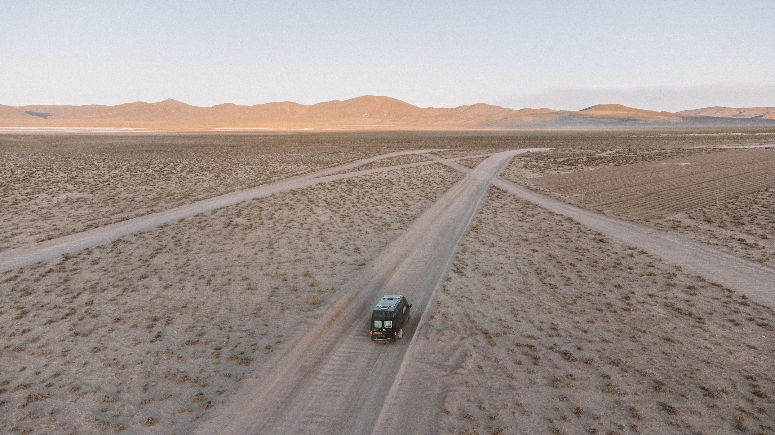
“Stick on the right! Stick on the Right!” Lucy calls as we trundle along the sandy track – my eyes focused intently as I try to avoid careening our heavy Ford Transit into a hazardous drift. I swing the wheel hard to the right and immediately grind to a halt. Confused, I look across at Lucy, who shares my puzzled expression. “What are you doing?” she exclaims. “I said, it’s thick on the right!”. I laugh, seeing the humour in the miscommunication that led to our unfortunate situation.
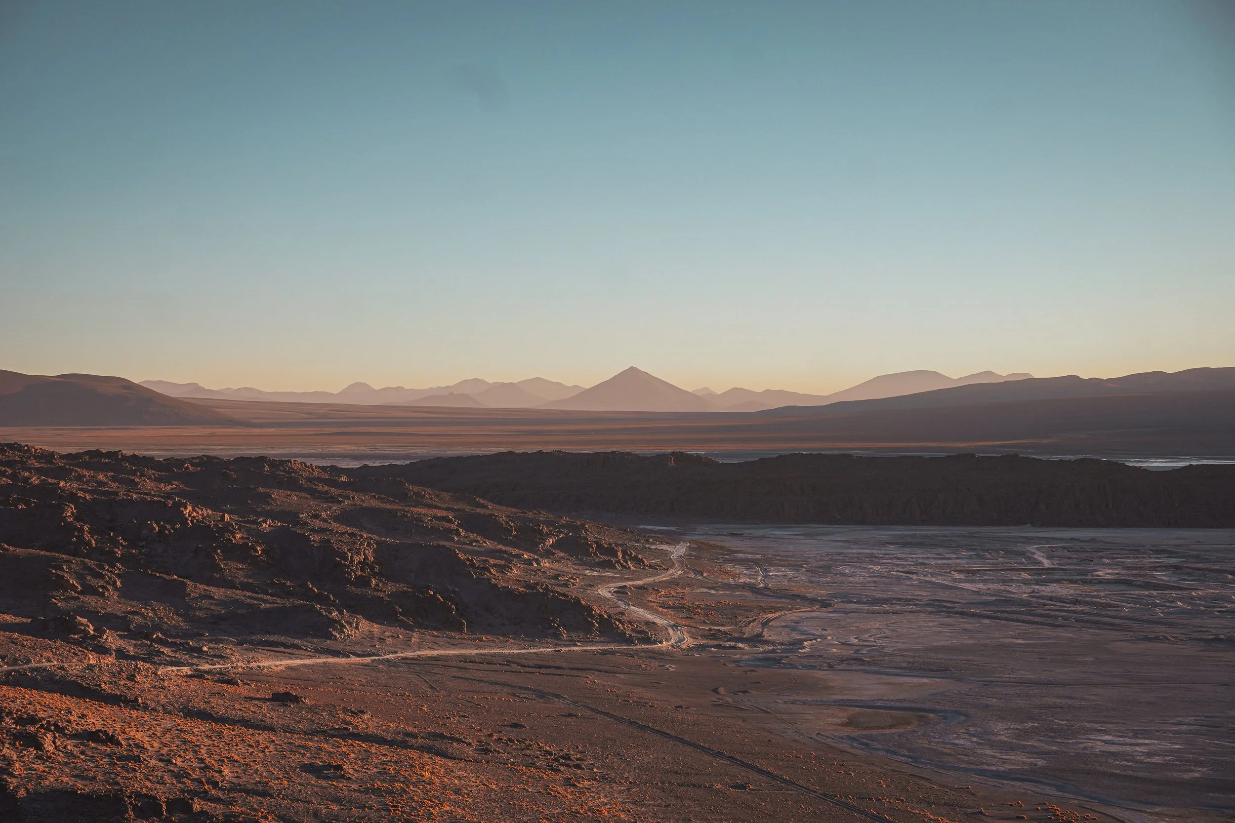
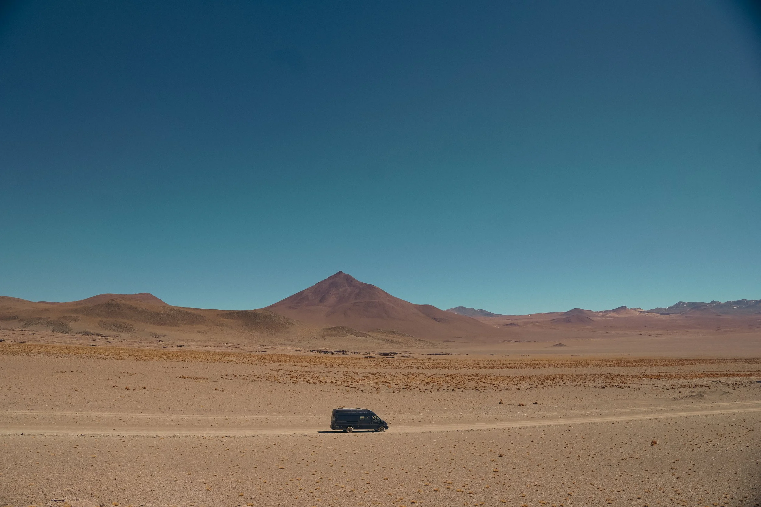
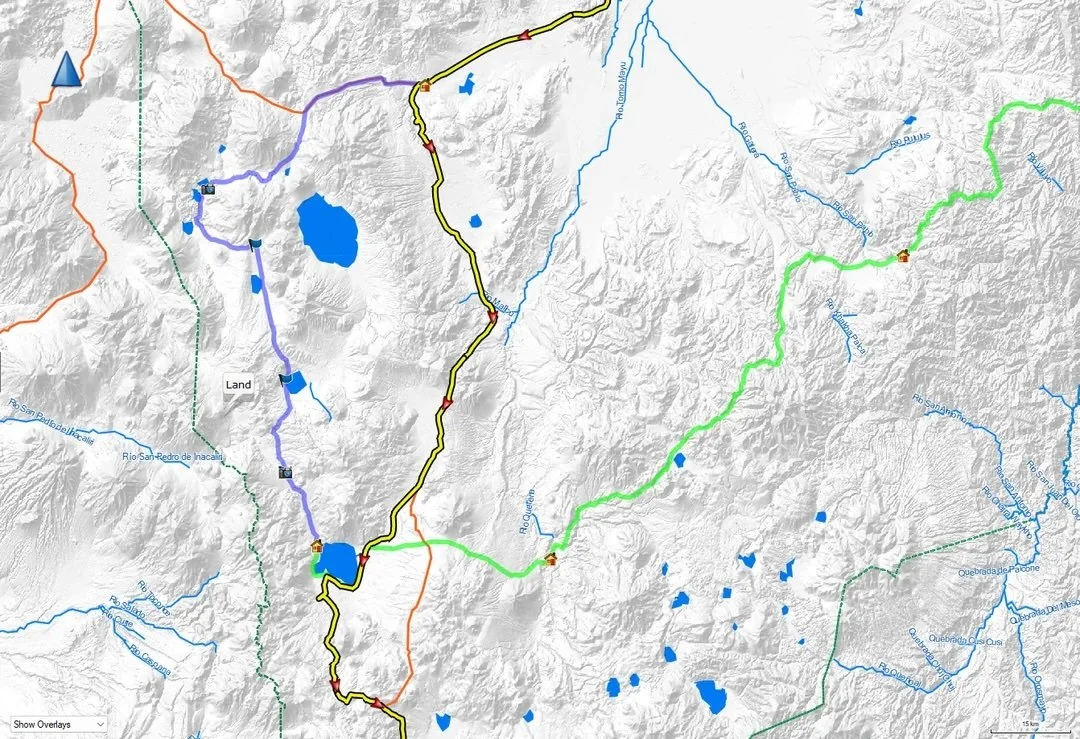
Considered one of South America’s most adventurous drives, the Ruta de las Lagunas in south-west Bolivia passes through some of the most remarkable high-altitude terrain on the American continent reaching altitudes up to as much as 5,000 meters.
The route is roughly 285 miles long; however, the entirely unpaved road doesn’t always appear on navigation software, making the journey a challenge, but a very invigorating one that will likely awaken a sense of exploring the uncharted that is hard to find these days. There is little to no infrastructure on this route, and so you’ll need to provision your food, water, and fuel.

We drive the route over a period of five days, but you could do it in less with a vehicle more suited to the terrain. Personally, I think the slower you go, the more time you’ll have to enjoy the otherworldly scenery.
The route gets its name from the multi-coloured lakes that pepper the otherwise arid landscape. The dark red of the Laguna Colorado is captivating, caused by algae and plankton. Laguna Blanca displays a milky white from the borax minerals, whereas Laguna Verde is a staggering green-blue formed from copper deposits. These vast lakes form the backdrop for the thousands of James, Andean, and Chilean Flamingos that flock here, and bring this world to life.


Vicunas, the wild and elegant cousin of the Llama, bounce alongside the dusty road as it winds ever higher into the Andean mountains. Armadillos and lizards scuttle up verges as we pass. Steam erupts upward and mud bubbles within geothermal craters – a common sight in this area due to its location on the Pacific Ring of Fire.
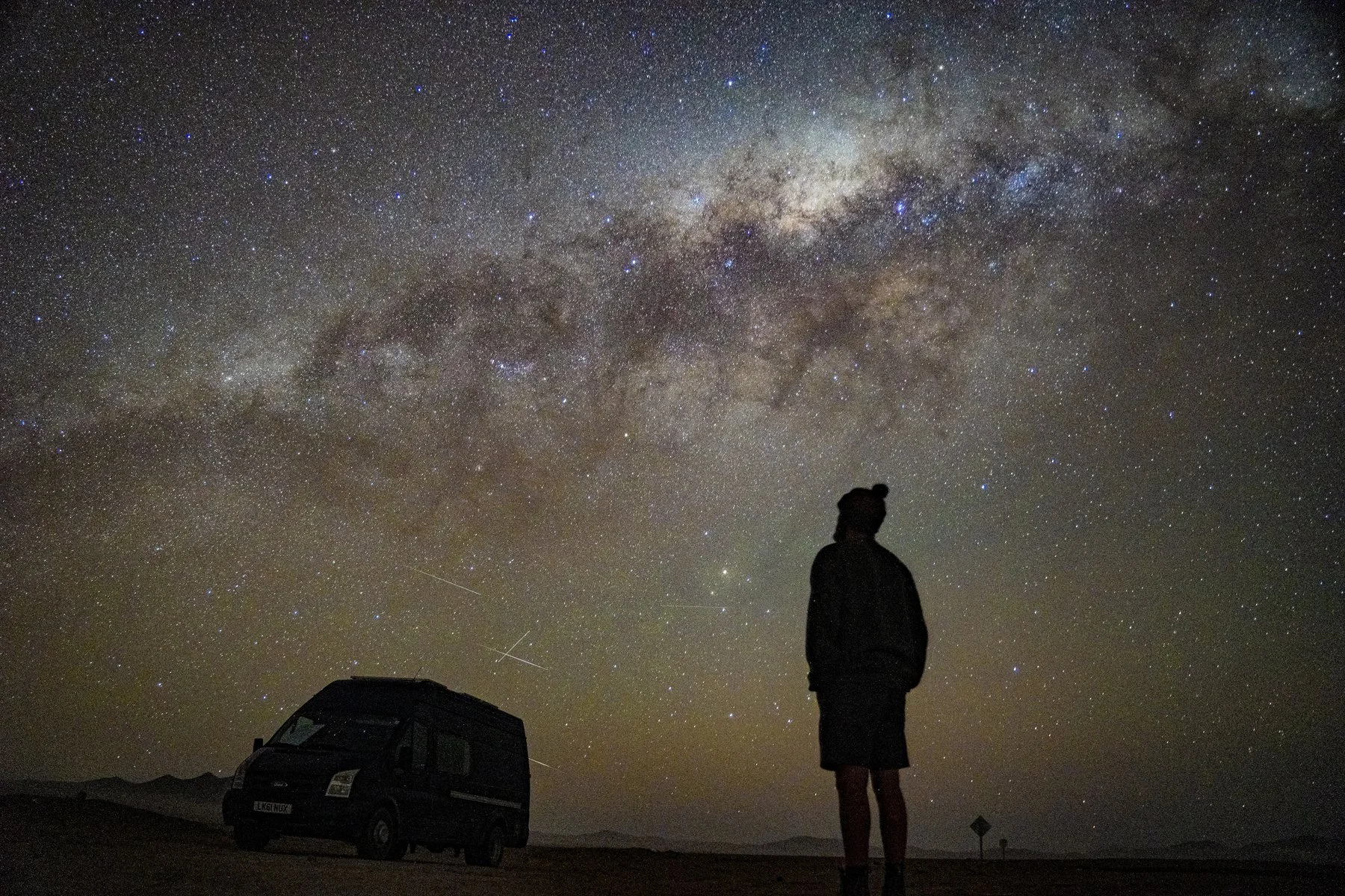
The local indigenous peoples, such as the Aymara and Quechua, consider the volcanoes and lakes as sacred places, and when you look up at the night sky, you can really get a sense of why this part of the world is so spiritual.
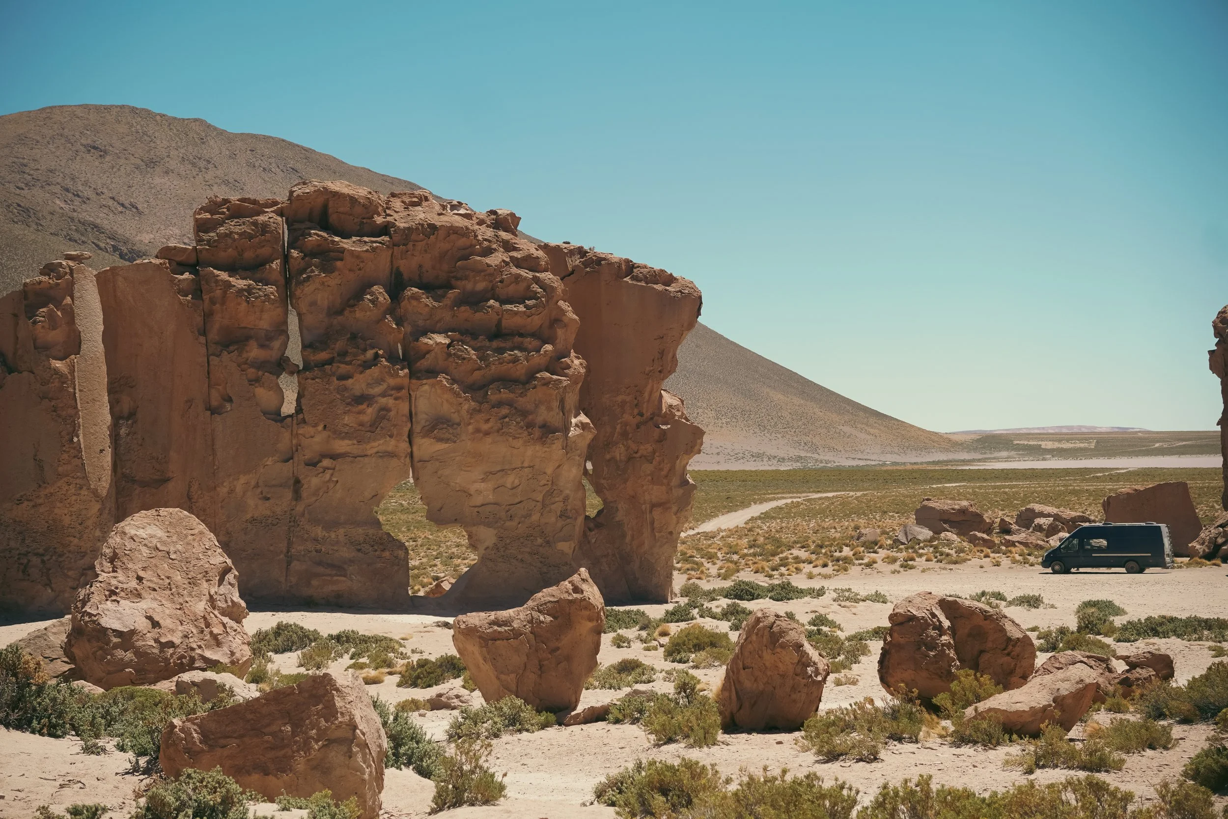
Attempting the Laguna Route is a worthwhile endeavour, but by now you’ll realise it comes with its challenges. If it’s not getting stuck in the sand (an angled reverse on a slight downhill evaded this situation from worsening), then it’s the rocks ricocheting off your metalwork, grinding along your undercarriage, or the dust clogging your air filter. And, as our fuel consumption rockets, air temperatures plummet, resulting in rough starts and alarming plumes of smoke billowing from our exhaust – much like steam from the volcanic pits. What’s more, as the metal components in our engine contract, previously hidden leaks begin to reveal themselves.
Driving this route is the ultimate overlanding test and pushes our low-clearance Transit to the limit of its capabilities. Yet, with risk comes reward. Watching the sun set while soaking in thermal pool alongside
Words & Photography James Hearne Instagram


ROADBOOK
CLASS: High ALtitude adventure
NAME: Laguna ROute
ROUTE: Uyuni to San Pedro de Atacama
COUNTRY: Boliva
Distance: 285 Miles


One of the highest navigable routes in the world, the Ruta de Las Lagunas is an off-road adventure with many risks, but just as many rewards.