
Detour #320: A Loop of the Lovely Llŷn Peninsula, Wales

Photo Indi Bains
From the green green grass of the valleys to the highest peaks this tour of the Llŷn Peninsula is a day detour to savour.
What better way to spend a day than exploring the Llŷn Peninsula, that rugged arm of land stretching west from North Wales that the town clings to the underside of? The only decision is whether to make this circular trip clockwise or anticlockwise. I’d like plenty of views, and a glimpse of Ynys Enlli, or Bardsey – that legend-soaked island off the Llŷn’s tip – and anticlockwise looks like it might do the trick.
Heading north out of Pwllheli on the A499, it doesn't take long to be enveloped in green fields, with blossom-filled bushes crowding the roadside. The tarmac gradually gains elevation, passing horses in undulating pastures. To the right, Tremadog Bay sparkles, with the greyish-purple smudges of Eryri’s (Snowdonia’s) peaks beyond.
At Llanaelhaearn, I turn left onto the B4417, a mostly single-track road that immediately ascends steeply towards the Llŷn’s three highest peaks – Yr Eifl, or the Forks – where legend tells of giants who constructed the Tre'r Ceiri hill fort, now known to date from the Iron Age. The verges jostle with bluebells, a smattering of yellow gorse brightens the higher ground, and scree crowns the summits.
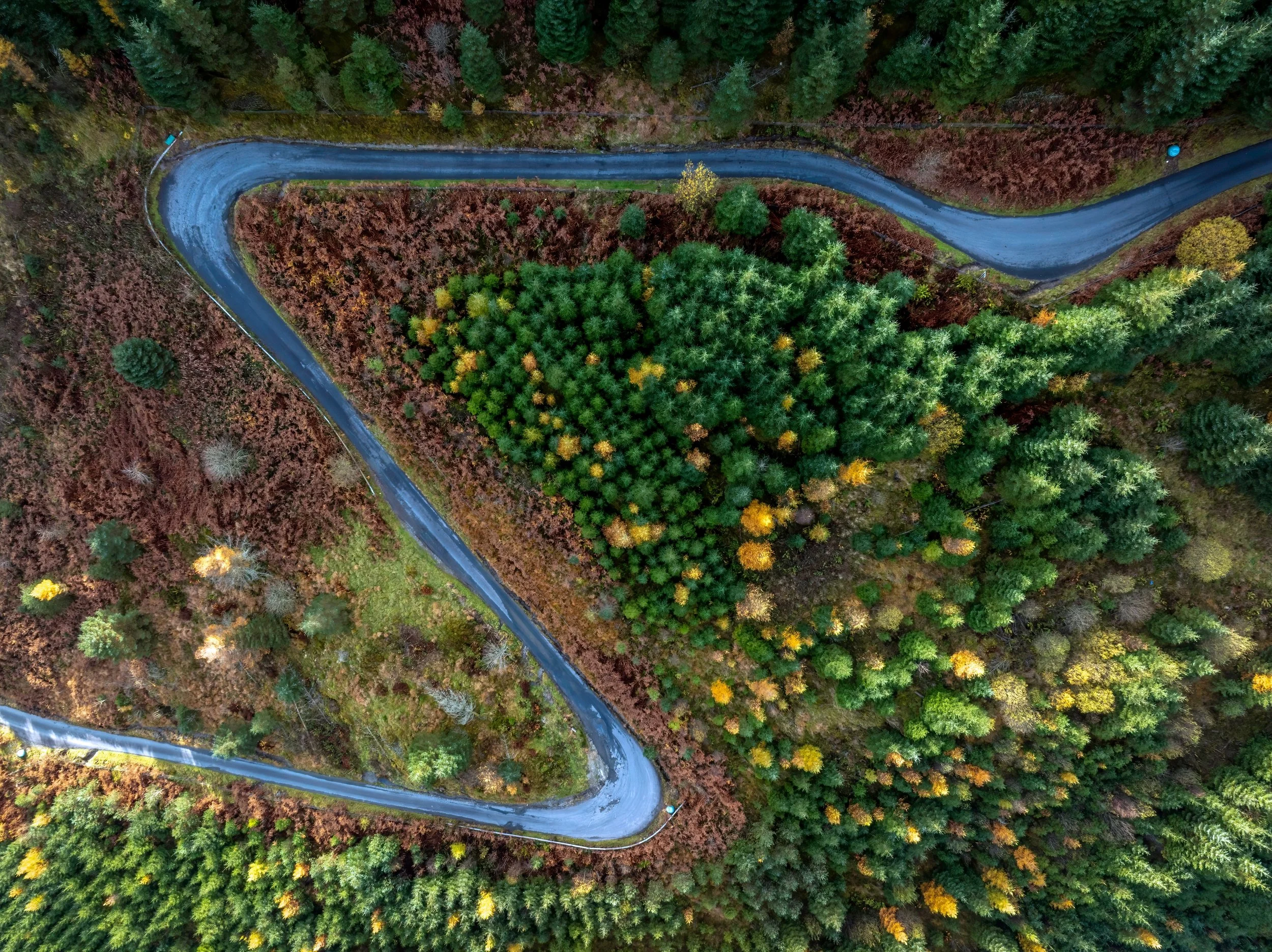
From Llithfaen, the road winds down in a pleasing series of hillside-hugging S-bends, and from this height the whole of the Llŷn stretches in front – coast shimmering on all three sides, and the more distant Mid-Wales coastline fading into the horizon.
Near Pistyll, I fancy I glimpse Ynys Môn (Anglesey) – a hazy green sliver in the rear-view mirror – just as Porthdinllaen appears ahead, its golden arc home to the world-famous Ty Coch Inn. It’s hard to know where to look, but the one thing I haven’t seen yet is Bardsey.
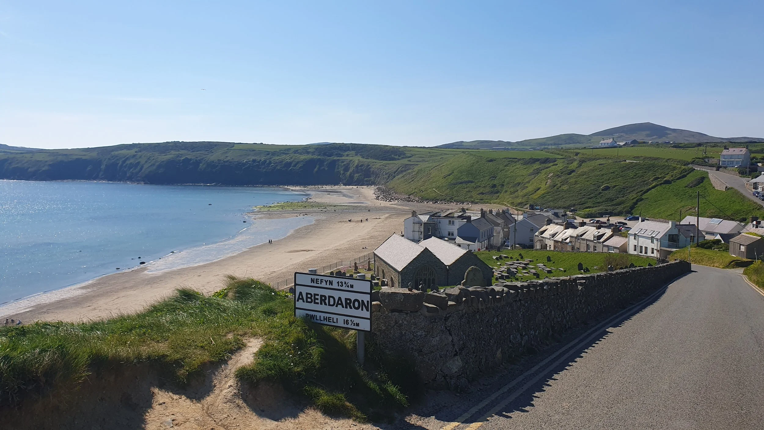
After dipping inland through Nefyn and Morfa Nefyn, I’m back among rolling farmland, punctuated with oddly shaped hills and craggy igneous outcrops, with sea glimpses. The road, unmarked and barely two lanes wide, forces me into the verge to let a determined small bus squeeze past. Then it’s a ninety-degree bend before joining the B4413 towards tiny, blink-and-you’ll-miss-it Aberdaron, with its stone bridges performing a veritable U-turn that has me rising steeply back out of the village in no time.
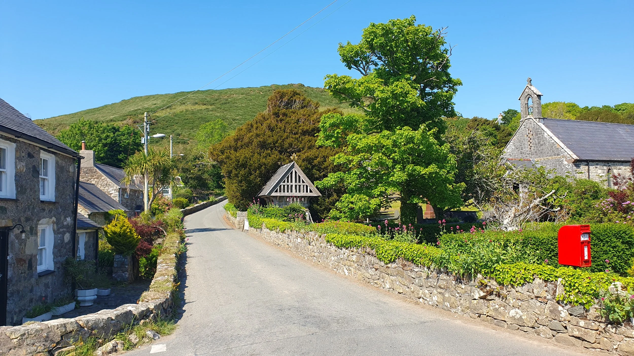
The narrow lane climbs to Rhiw, past whitewashed cottages and pink wildflowers bursting from high verges, the occasional pheasant chancing a dash across the road. Reaching the junction in Rhiw, I’m sure Bardsey must be behind me. I stop – and there it is: its humpback profile arching elegantly away from the Llŷn’s tip.
Back in the car, I descend rapidly down a 20 per cent gradient along the flank of Mynydd Rhiw, marking an abrupt switch from panoramic views over the Llŷn’s north coast to those over its south, with Mid-Wales stretching beyond. The maw of Porth Neigwl – Hell’s Mouth, where many mariners met a grisly fate – yawns ahead, yet today, a placid turquoise, it couldn’t look any less threatening.

The road levels out, carrying me over long bridges across marshy fields edged with hawthorn as I turn towards the picture-perfect village of Llangian. At Llanengan, I take the undulating lane toward Abersoch, with views of Tremadog Bay and Eryri opening once more as I approach the town’s outskirts before passing a massive, rocky headland jutting into the sea.
Suddenly, I’m back on the clearly painted two-lane A499 – a seeming motorway after the northern Llŷn’s dawdling lanes – whisking me back to Pwllheli with no thought of views.
I’ve seen Eryri, Ynys Môn, Yr Eifl, glittering coastlines galore – and Bardsey. But the question remains: would the views have been better going clockwise? I’ll have to turn around and find out.
Words & Photography Indi Bains
ROADBOOK
CLASS: Coastal cruise
NAME: Llŷn Loop
ROUTE: Pwllheli to Pwllheli
COUNTRY: Wales
Distance: 46 Miles


Detour has joined forces with route-planning app MIVIA to share our favourite British driving roads with an even wider car community.