
Detour #237: Tied up in knots on the Lacets de Montvernier, France

Claustrophobia and vertigo sufferers turn away now. The climb to Col du Chaussy in the Auvergne-Rhône Alpes is a narrow, steep and nerve-wracking ascent.
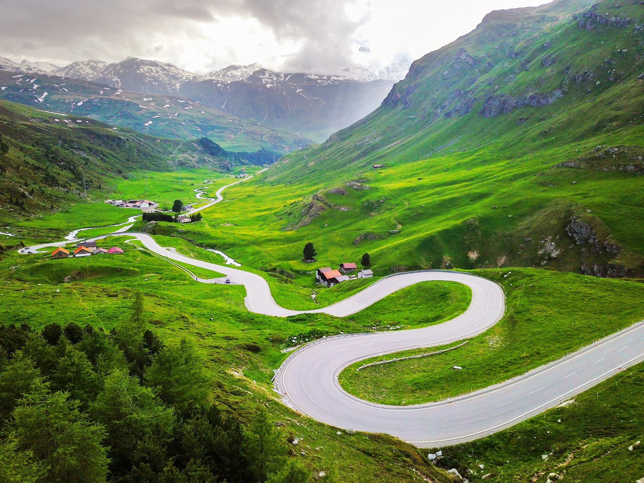
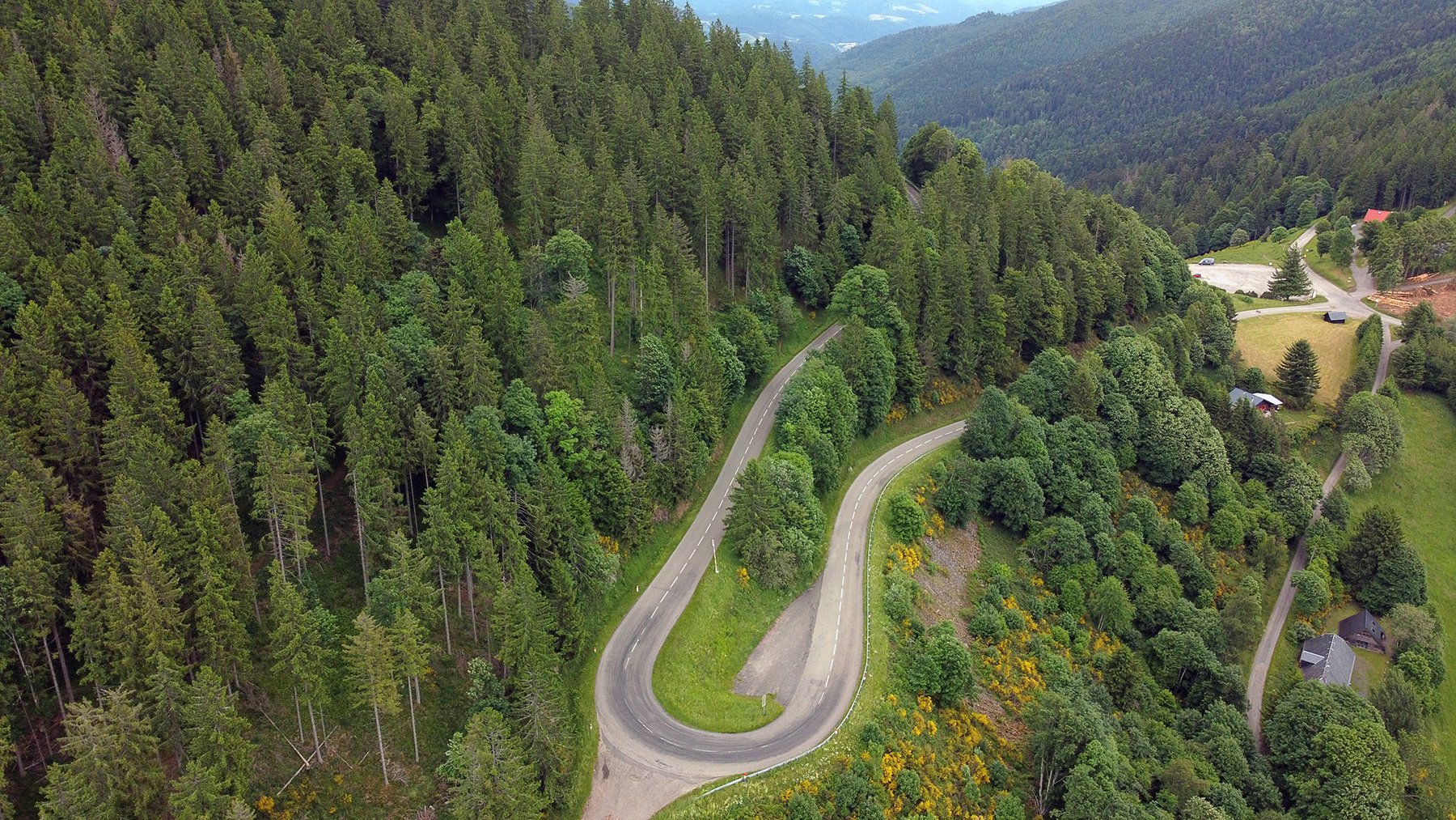
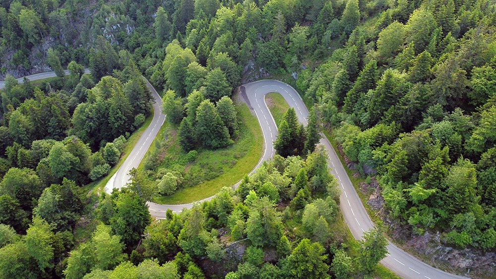
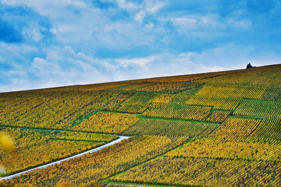
It’s known locally as Les Lacets de Montvernier – the shoelaces of Montvernier – and it threads its way up a sheer cliff wall in a series of back and forth loops that really do resemble footwear fastenings.
Look at this deranged doodle on a map, study the photographs, or even view it from the main road outside Pontamaffrey and what you won’t be able to comprehend is just how slender this sinew of road really is.
Built to replace an old mule track between the villages of Montvernier, Montbrunal and Montpascal, the route was planned in 1900, although work only began in 1931. It was, quite understandably, a troubled construction. The first firm employed to attempt to build the road abandoned it soon after starting, but a second, more determined crew of 36 workers managed to complete the job in only 11 months, despite working with just hand tools.

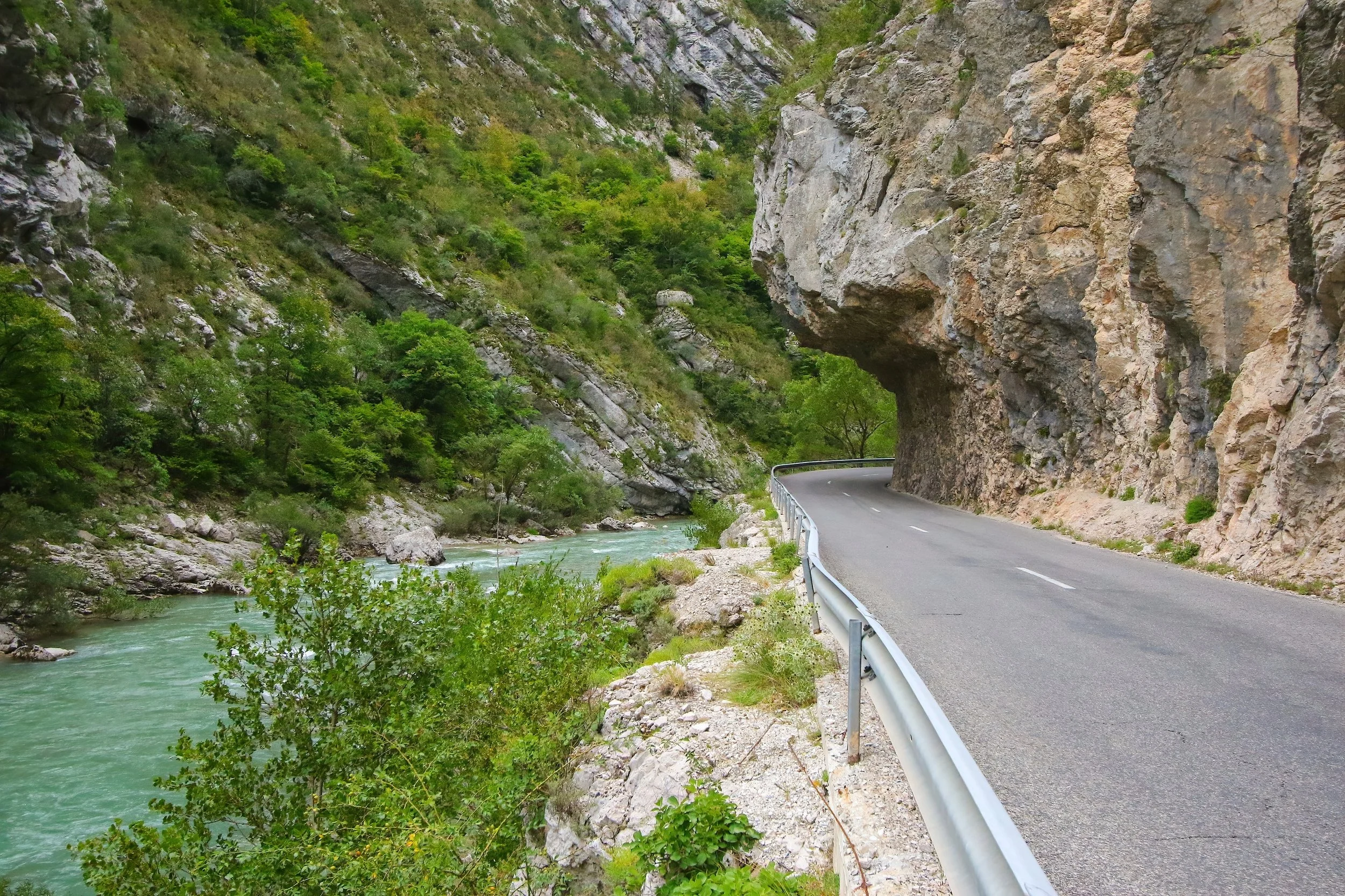
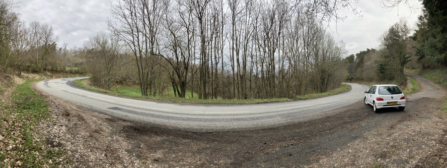
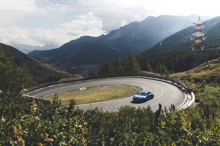
While the D77B must have been a blessing for local villagers in their compact Citroëns it is, almost a century later, something of a nightmare to navigate in a modern car. The road is so narrow that it feels you’re in constant danger of scraping against the cliff wall or dropping over the edge.
Even in a relatively-miniscule Mazda MX-5 the road closed in around the car and I needed to be inch-perfect at every turn to avoid damaging paintwork or plummeting to my demise.
In the space of just three kilometres there are 17 hairpin bends to negotiate, some so tight that you might need more than one attempt to get round. There’s one every 150 metres or so, making the 400m vertical climb a constant exercise in arm-twirling. Vehicles on the up have priority over those heading down, but finding a place to pass safely will inevitably involve some precarious manoeuvres at the precipice.
Fortunately, an alternative, and much less stressful, route was built in 1970, so the only traffic you’ll encounter will be those determined to conquer the Col. Most likely they’ll be on two wheels, inspired by the road’s inclusion in the 2015 Tour de France.
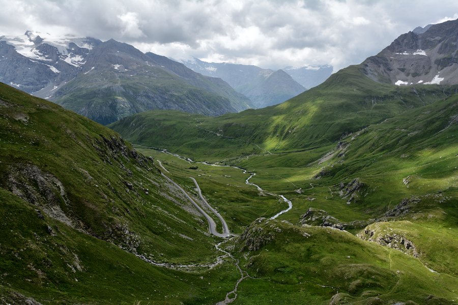
After the grind to Montvernier there’s still quite some way to go, albeit a much more gradual rise through alpine meadows, then returning to the mountain’s edge to offer glorious views of the valley below. Then things get steeper and twistier once more as you approach Montpascal and close in on the summit.
At the top you’ll find the Auberge de Chaussy where you can take a break, tuck in to some local dishes, and steel yourself for the descent.
Words Nik Berg Twitter/X | Instagram
Photography Shutterstock

ROADBOOK
CLASS: MOUNTAIN PASS
NAME: LACETS DE MONTVERNIER
ROUTE: Pontamafrey to Col du Chaussy
COUNTRY: FRANCE
Distance: 9 Miles


The Alta Via Del Sale isn’t for the fainthearted, but the payoff is worth it.