
Detour #256: Seeking Sunset at the Grand Canyon’s North Rim, USA
Photo Shutterstock
Ask a local and they will say you have not seen the Grand Canyon unless see it from the North Rim – and there is one very special road that can take you to the best view of all, bar none. Especially if you drive it when the sun goes down.
There is just 11 miles separating the two sides of this natural wonder, as the crow flies, but it feels more like a million. Here, there are wider, deeper and far more expansive vistas and because it sees just ten per cent of the area’s annual visitors, it is far more peaceful and serene than the tourist trail on the opposite side.
One of the reasons for this is simple. It is hard to get to. It sits more than 200 miles from any major city – the closest being Flagstaff or Las Vegas – and it is even a four and a half-hour drive from the South Rim. In fact, once you leave Jacob Lake (which incidentally has no lake!) on the Grand Canyon Parkway, the only route in, there is little else but trees, deer, elk and wild turkeys; perhaps even a black bear or mountain lion.
Initially I follow the Parkway straight to the North Rim Visitors Centre, which is well worth a trip to look around the fascinating exhibits and grab some tips from the informative guides. However, I then backtrack a few miles to a turning onto Cape Royal Road, just at the end of Thompson Canyon, where my sunset journey begins.
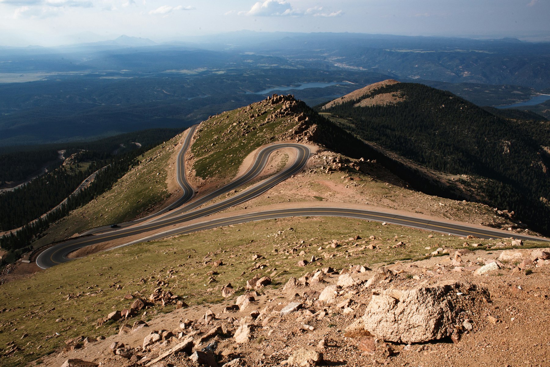
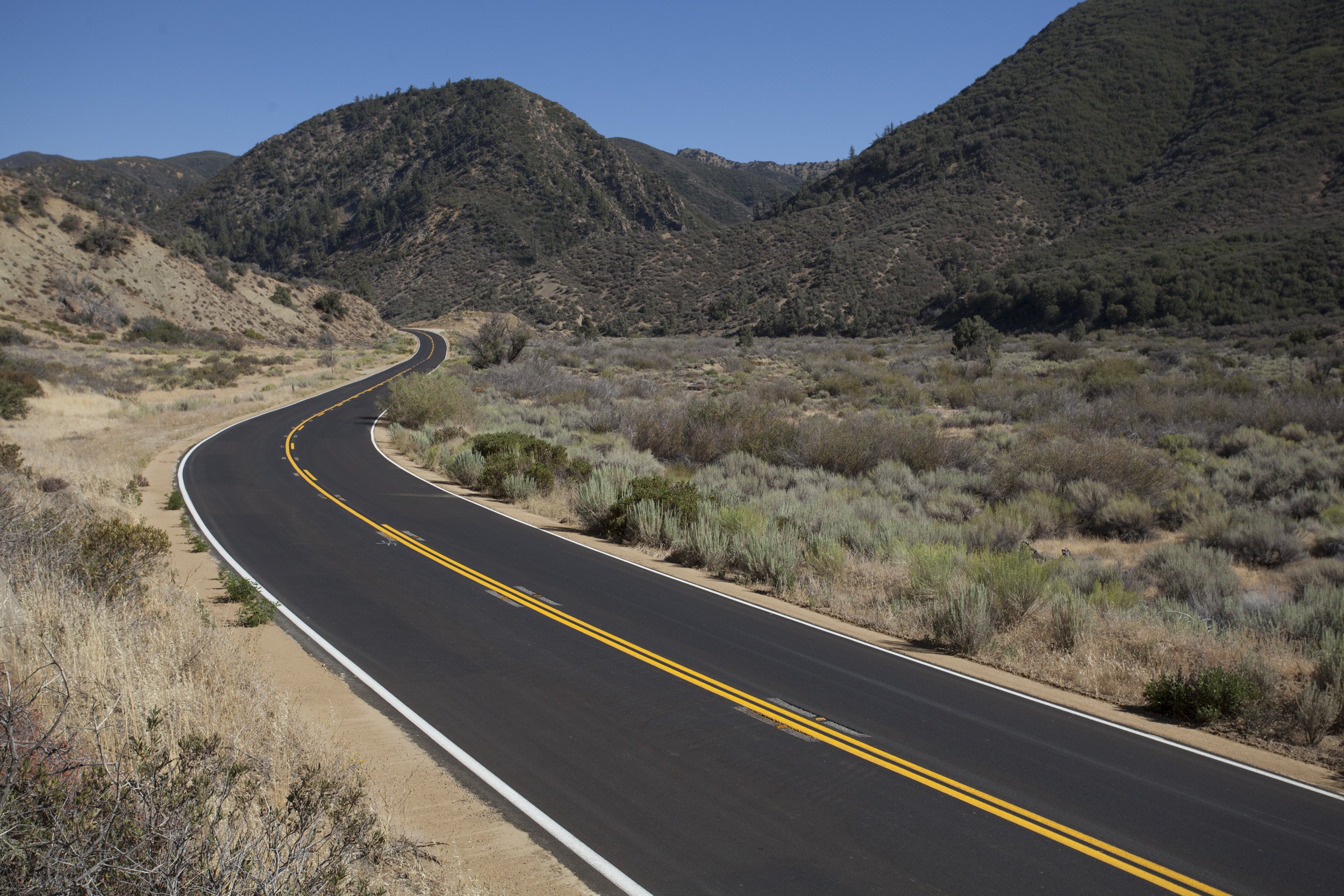
The winding paved two-lane road runs approximately 20 miles through pine, fir and aspen forests, offering fleeting glimpses of sheer drops and wide vistas as the canyon sides come and go. But it is the jaw-dropping stopping points along the way that make this dive truly memorable.
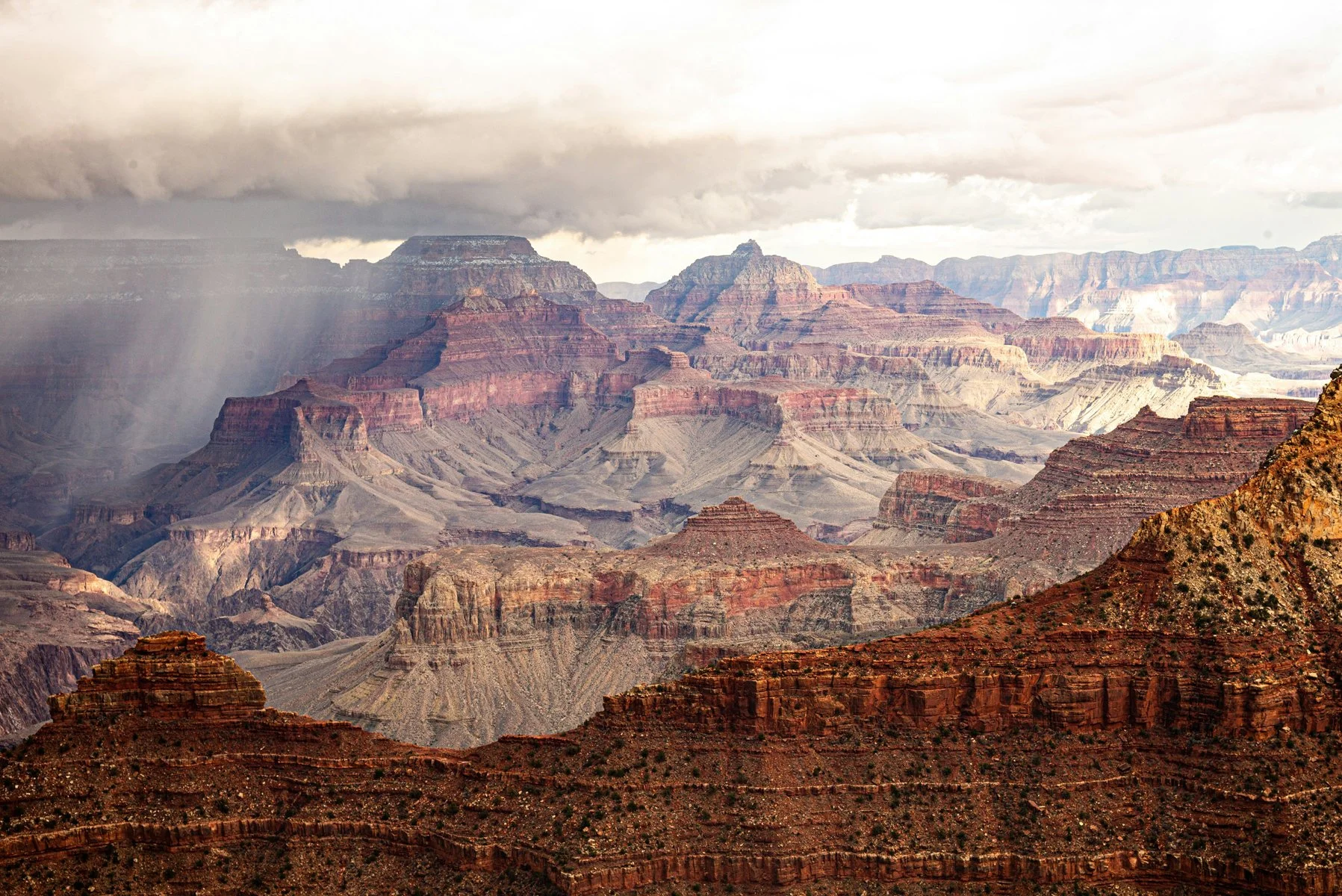
Photo Vu Bui/ Unsplash
The first of these is Point Imperial, which sits at the end of a 2.6-mile spur road, accessed from a turn-off 5.4 miles into the main route. My stomach churns at the teetering drop-offs as the road hugs to the canyon edge before reaching the highest viewpoint on the North Rim. There, I take my first view of the eastern canyon and the Painted Desert spreading, with stark layers of red and black rock and the unique pointed pinnacle of Mount Hayden making for a memorable view.
Once back on the main route, I wrestle the wheel through a series of 16 switchback turns, descending 400 feet to Roosevelt Point to see the confluence of the Colorado and Little Colorado rivers. The road then traverses the Walhalla Plateau from its northern side to the southernmost vantage point, where I leave my car behind for a short, flat half-mile walk past Angel’s Window to Cape Royal, the place where, more than anywhere, north or south, the canyon truly lives up to its ‘Grand’ title.
This stunning viewpoint juts out into the abyss, presenting a jaw-dropping 270-degree sight of one of the Earth’s greatest natural wonders. Huge, wide views stretch to the east, south and west, with rock features including Wotan’s Throne, Vishnu’s Temple, Desert Watchtower, Grandview Point and Horseshoe Mesa. And I have timed it perfectly, the setting sun turning the eastern walls red before dropping below the western rim, plunging the canyon depths into darkness and spraying the sky with shades of pink, orange and purple.

Photo Shutterstock
But the wonders don’t not end there – because this is an out-and-back route, and as night descents, there is one stop that is worth visiting once more. Navigating back through the black makes the return trip far more challenging, especially with the added threat of roaming animals around every corner, but when the skies are clear, that side spur back up to Point Imperial leads to a real out-of-this world wonder as the Milky Way begins to wake up.
Words Will Gray
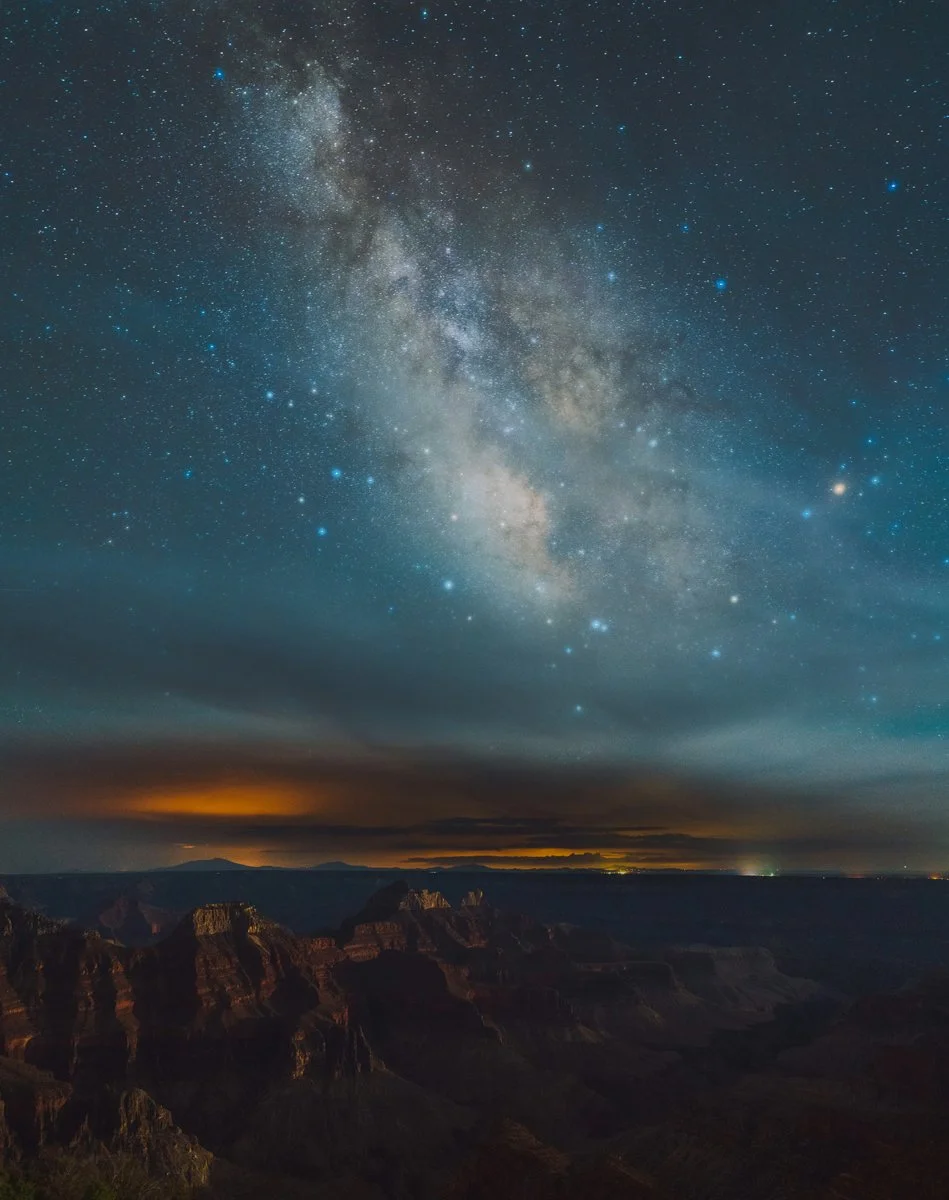
Photo Yifu Wu / Unsplash
ROADBOOK
CLASS: natural wonder
NAME: Grand canyon north rim
ROUTE: JAcob Lake To Point Imperial
COUNTRY: UsA
Distance: 80 Miles


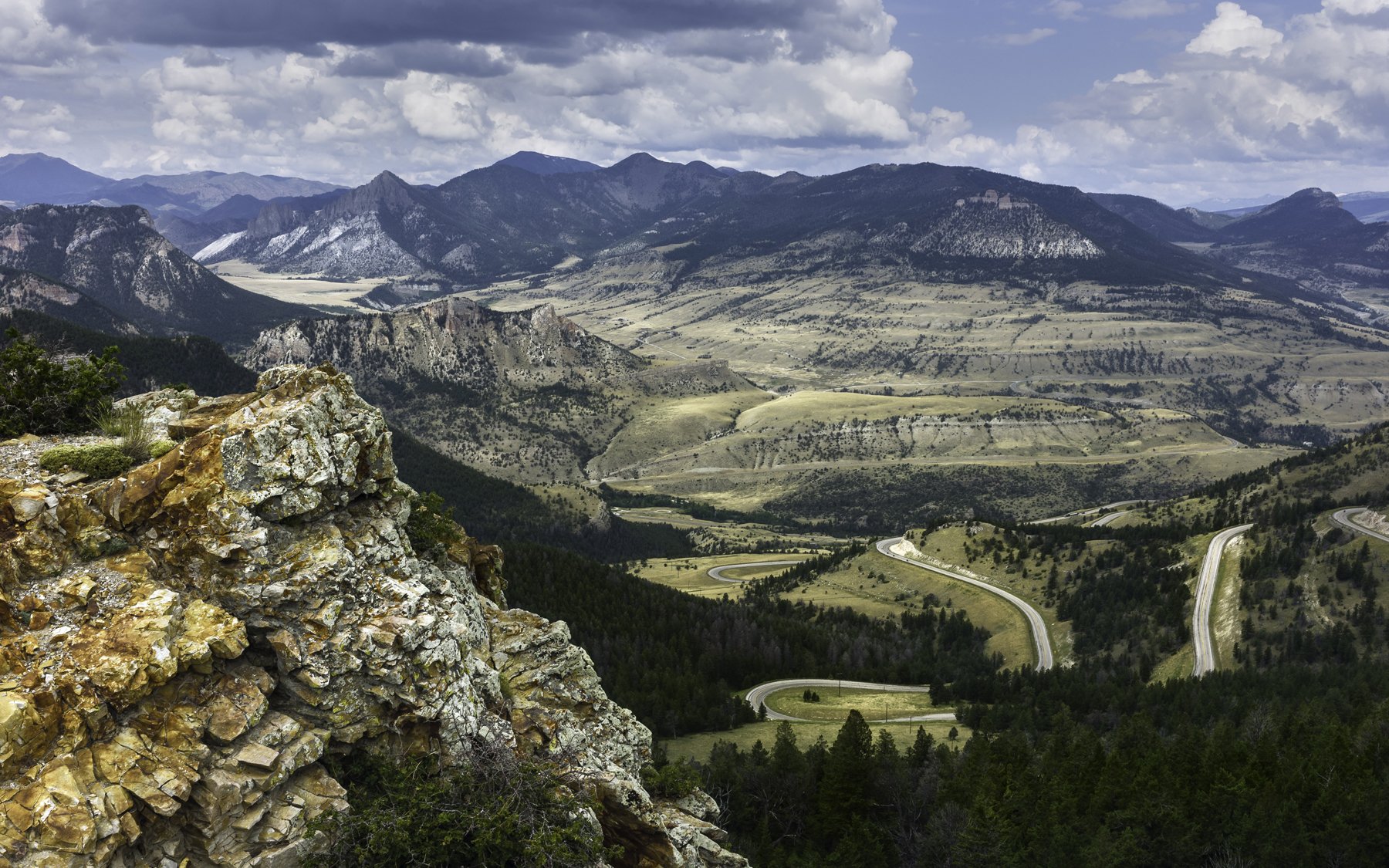


In Taylor' Sheridan’s Yellowstone the Dutton clan are forever driving across the breathtaking Montana landscape. Here’s how to follow them.