
Detour #293: Ocean Driving in the Outer Banks, North Carolina, USA
Off the coast of North Carolina the Outer Banks National Scenic Byway is a drive back in time.
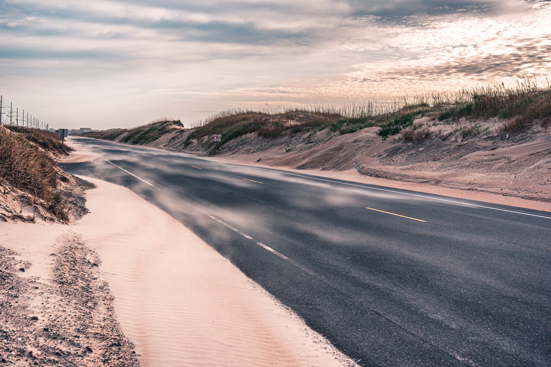
The nine barrier islands of the Outer Banks have protected North Carolina from the worst of the Atlantic weather for millennia. Yet, despite the often mighty meteorological moments, the islands themselves have remained largely unchanged since Americans first began to take advantage of the rich waters. That makes a drive along the 138-mile Outer Banks National Scenic Byway a road trip to a more simple time.
Locals call this community of fishing villages ‘Down East’ and, as you motor slowly along the island corridor of US Route 64, you’ll pass old clapboard family homes, churches, harbours, lifeboat stations and lighthouses, along with a wildly diverse environment that’s teeming with wildlife.
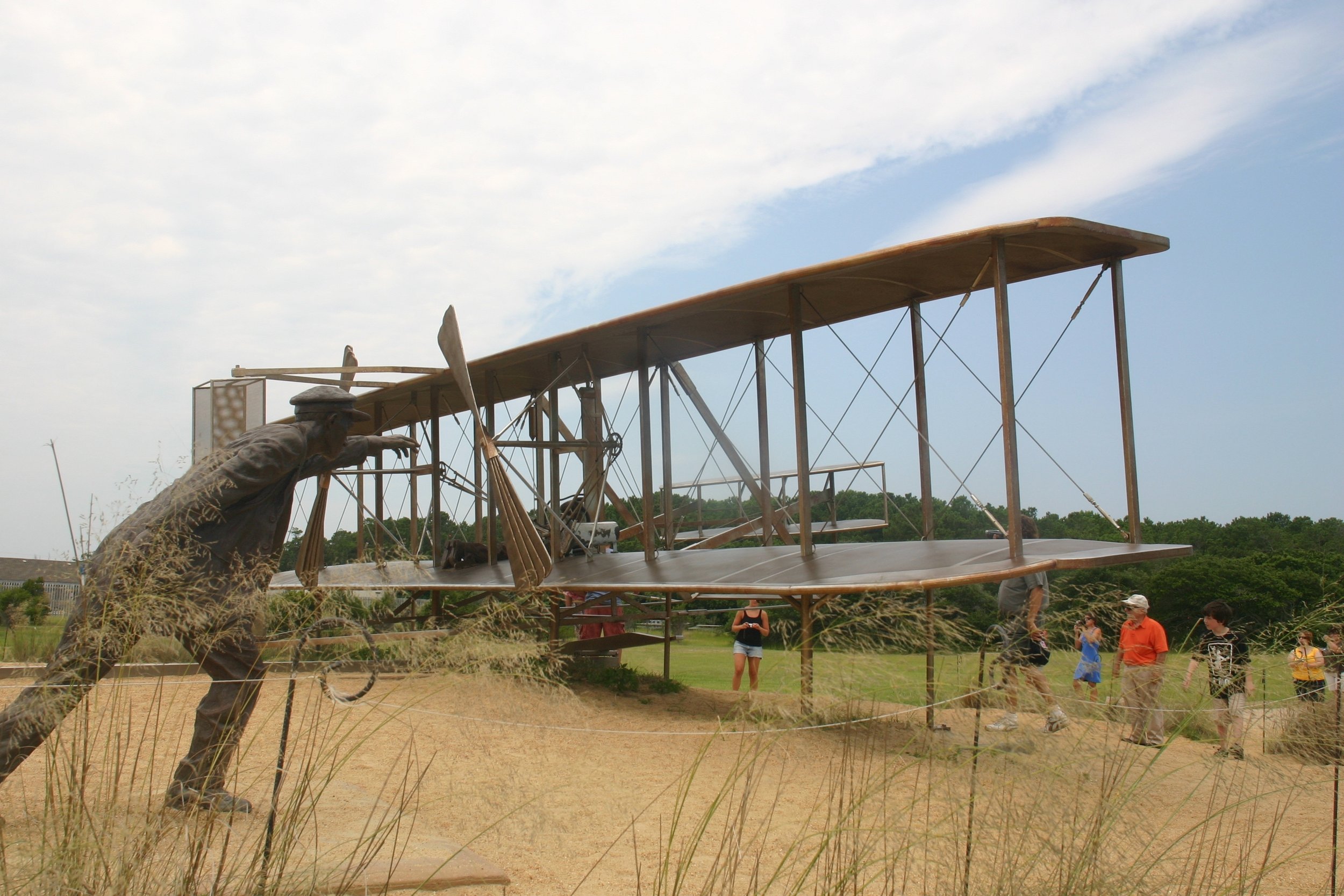
Leave the mainland at Manns Harbor and you’ll cross a bridge over the Croatan Sound to Roanoke Island and its marshes, which are a hotspot for waterfowl and the binocular-bearing birders who love to observe them. Another bridge leads to Whalebone where fans of manned-flight should take a detour to Kitty Hawk, where the Wright Brothers famously first took to the skies in 1903.
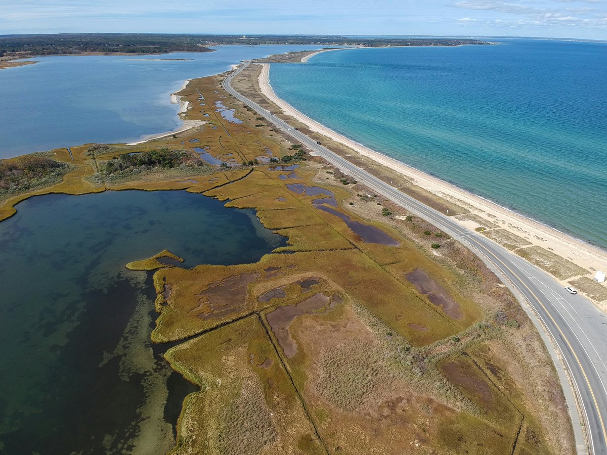
As you travel south you’ll travel through a landscape of dunes, marsh, and water in the Cape Hatteras and Cape Lookout National Seashores and the national wildlife refuges on Pea Island and Cedar Island. White sandy beaches, tidal flats, maritime forests and all their various inhabitants are the theme of this first part of the byway.
On Hatteras the vibe changes to more of a beach holiday feel with colourful stilted houses, hotels, eateries and watersports. Talk to a real local and you’ll hear the Down East brogue, which has echoes of 17th century English. Catch the hour-long ferry to Ocracoke Island and you’ll find little signs of civilisation until you reach the village of Ocracoke where another ferry will bring you to Cedar Island two and a half hours or so after you board. It’s the last link in the island chain before you rejoin the mainland.
Words Nik Berg Twitter/X | Instagram
Photography Shutterstock


ROADBOOK
CLASS: Ocean Drive
NAME: Outer Banks National Scenic Byway
ROUTE: US 12, Manteo to Beaufort, North Carolina
COUNTRY: USA
Distance: 150 Miles


In Taylor' Sheridan’s Yellowstone the Dutton clan are forever driving across the breathtaking Montana landscape. Here’s how to follow them.