
Detour #232: The road that Calum built, Raasey, Scotland
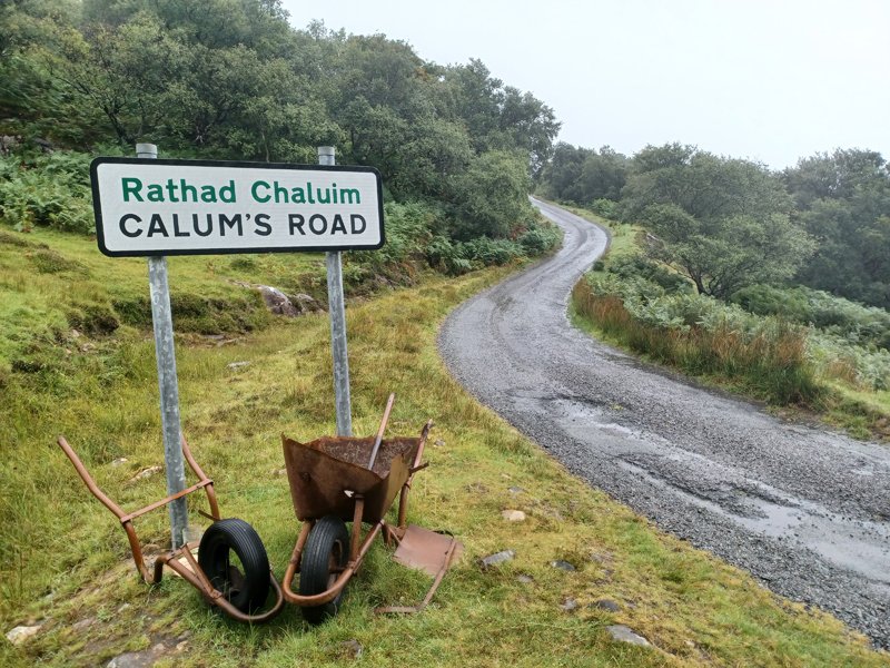
it’s less than two miles long but it took one determined man over a decade to complete calum’s road.
Today, with the rain on Skye best described as horizontal, I’ve been lured by thoughts of kinder climes to its lesser-travelled sibling. I have it on good authority that Raasey is less subject to meteorological whims; furthermore, the tiny island has been on my radar since I first heard about Calum’s Road.
The eponymous Calum MacLeod was a native of Arnish in northern Raasey. Originally the most populous part of the island, it lacked a road, a probable factor in the township’s decline. In an heroic Hebridean tale of single-minded determination, Calum dispensed with the officialdom that kept ignoring locals’ petitions for connectivity, and almost single-handedly constructed a 1.75-mile stretch of road with little more than a wheelbarrow, pick, shovel and axe, between the mid 1960s and 1970s. I wanted to see it for myself.
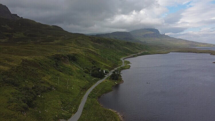
Arriving at Sconser Ferry terminal, any thoughts of climatic kindness rapidly vanish. Raasey is almost invisible though dense drizzle, even as we dock in tiny Inverarish. Taking the road north via Oskaig, I opt for dipping up and down along the coastal route. Raasey is mostly single-track, but I have no need of the passing places as I rarely see another motorist; my main tarmac sharers are of the ovine variety and even more stubborn than their Skye cousins.
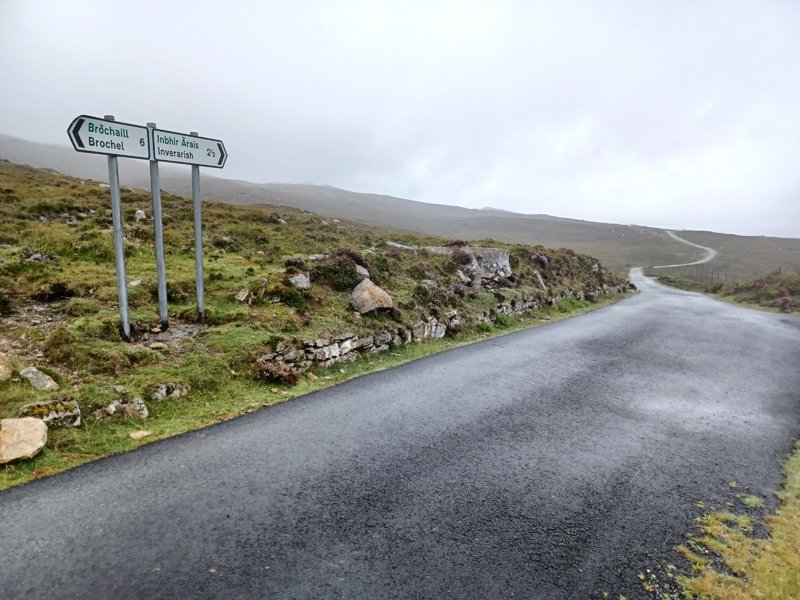
A broad switchback leads to the ‘main’ road which heads straight northwards for nearly four miles. A spine like this should afford spectacular views to Skye’s Trotternish Ridge but the weather is obstinate, so I content myself with misty fern- and heather-clad lumpen hillocks and an imagined view of the splendour beyond. Taking a sharp dogleg right, the road meanders through high, sodden moorland before reaching the east coast. The eerie fingers of Brochel Castle’s ruins reach unevenly into the gloom opposite the sign marking the start of Calum’s Road.
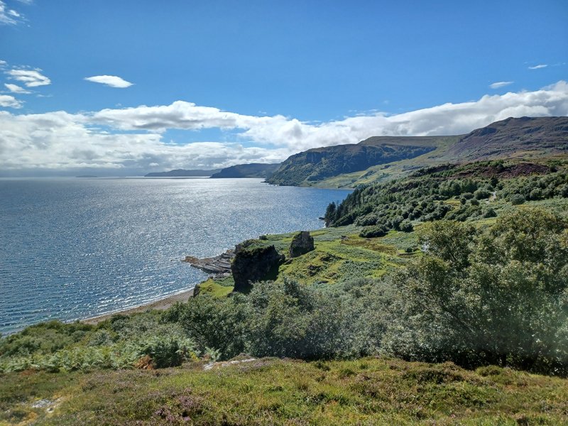
Now the Highlands spin their magic. After winding upwards a few hundred metres, I transition into a different world. Where a moment ago cloud swept the ground, now it abruptly disappears, a veil withdrawn in a ta-da moment. It’s hard to know whether the vista would have been as impressive without the big reveal. The view southwards is Kauai in miniature; lush, steep hillsides rising from a sea reflecting a brilliant sky, white mist filling crevices in daubs of perfection.
The remarkable thing about Calum’s Road is that it is rarely flat. It goes up and down, there are steep parts and a switchback; a sign on an unnetted section hugging a precipitous coastline warns of rockfalls into the clear bay beneath. It is amazing to think not only did Calum construct this road, he cleared and cut this terrain to do it.
The road terminates with a small parking area at Arnish. I choose a walking trail, bumping into a German couple who tell me they also came for Calum’s Road, but walked its entirety to fully appreciate it. I make a mental note for next time.
Heading south, I stay on the main road to Inverarish and Raasey House. The building, now a hotel and restaurant, dates to the eighteenth century, originally home to the MacCleods of Raasey. Time for a delicious dinner of local produce before continuing south.
The road stays coastal, with fantastic views to the Red Cuillin and Scalpay. I pass a watchful heron in a roadside cove before the tarmac peters out into a farm track. Returning to board the ferry, I’ve just the crew and a pod of dolphins surfing the bow waves for company.
I’ve ticked Calum’s Road off my bucket list and proven my friend’s meteorological prediction correct.
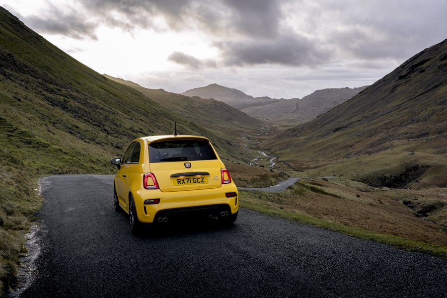
Words & Photography Indi Bains
ROADBOOK
CLASS: hebridean hero
NAME: CALUM’S ROAD
ROUTE: Brochel to ARNISH
COUNTRY: SCOTLAND
DISTANCE: 1.75 miles


Detour has joined forces with route-planning app MIVIA to share our favourite British driving roads with an even wider car community.